|
Hill Walking in South East England |
There are no mountains in the south east of England, and no mountain rescue either, in fact some would have you believe that the whole of the south east is as flat as a pancake. This is just not true, a quick glance at any map will show you that there are two long ridges and numerous lumps which have the word hill in their name. Granted the North and South Downs will not provide the wilderness experiance and may of the hills can be run up in less that half an hour but these minor points miss the fact that there are hills just waiting to be climbed.
The Marilyns
For those who need a list to complete there are 15 Marilyns to be ticked off. None of them should be treated too lightly as they all offer a certain something be it "hillwalking" up the main street in crowborough, mingling with the saturday shoppers or having a few cold drinks in the pub at the top of Botley Hill. Just because you'll never be more that a few miles from civilisation doesn't mean it isn't a challange.
The Marilyns of South East England
| Metres | Feet | Name | Map | Grid Ref. |
| 297 | 974 | Walbury Hill | 174 | SU 373616 |
| 295 | 968 | Milk Hill | 173 | SU 104643 |
| 295 | 968 | Leith Hill | 187 | TQ 139431 |
| 280 | 919 | Black Down | 186/197 | SU 919296 |
| 270 | 887 | Butser Hill | 197 | SU 717203 |
| 267 | 875 | Botley Hill | 187 | TQ 369553 |
| 248 | 813 | Ditchling Beacon | 198 | TQ 331130 |
| 240 | 788 | Crowborough | 188 | TQ 511307 |
| 240 | 786 | St Boniface Down | 196 | SZ 568785 |
| 238 | 782 | Chanctonbury Hill | 198 | TQ134120 |
| 217 | 713 | Firle Beacon | 198 | TQ 485059 |
| 214 | 702 | Wilmington Hill | 199 | TQ 548034 |
| 214 | 701 | Brighstone Down | 196 | SZ 432847 |
| 200 | 656 | Detling Hill | 178/188 | TQ 804586 |
| 164 | 538 | Cliffe Hill | 199 | TQ 434107 |
We will be doing them all in the coming months!!!
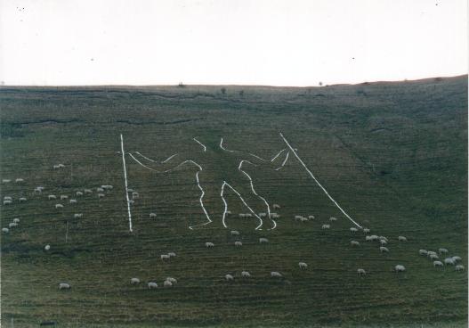 |
The Longman or a stranded paraglider - you decide |
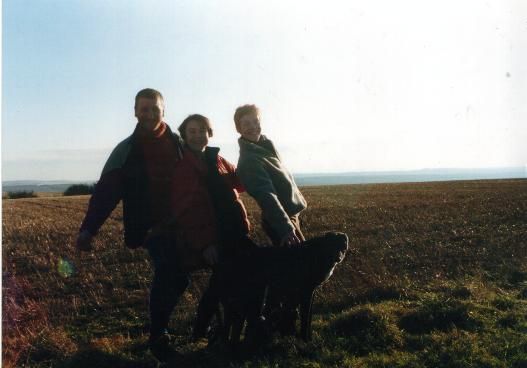
We started our Marilyn trail at Wilmington hill, there was no particular reason to start here it was just one of those bright and cold January days which says to you come out side and enjoy. And the south downs is a very good place to enjoy that sort of day. We could have lied and said that we chose this Hill because of the long man being carved in to the side of it signifying something or other but no, there was no reason to start here. Most of Wilmington has some connection with the long man, we passed the long man nursery, went up the road past the giant pub (not a big pub but a pub called the giant), parked in the long man car park and followed the long man foot path. Who ever carved the long man made the arms to long, if you took the two poles away his knuckles would swing along the ground. Maybe we had just discover proof of the missing link? We followed the foot path round the side of the hill and up to the top of the ridge. Ancient man had been very active round here and made our first summit of the day, a barrow it said on the map. We had to run to the top of the mound, it would have been rude not to, but our sentiments where probably not shared by the two walkers earnestly discussing the power of these ancient monuments.
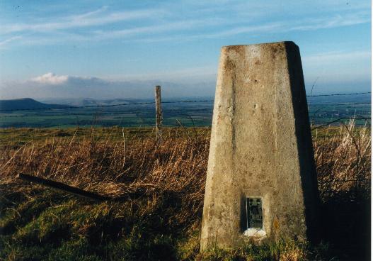 |
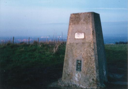
The Trig Point at Wilmington hill |
Now we where on the ridge we had to find the trig. point nearly every where seemed to be the highest point but we eventually found the top hiding in some bushes next to a fence. After taking the summit photo (after debating whether we really wanted Eastbourne in the background as it wasn't a very intrepid place) we ambled off the other side discussing the possibilities of brightening up trig points by painting them bright colours, This one could have a little long man painted on it or may be if w did it on Feb. 14 we could decorate it with hearts and flowers. The possibilities for annoying the woolly hat brigade where endless!
The team (Pete, Sarah, Angela and Flo) without Eastborne in the background. |
|
We rounded the walk off with pickled onion and chocolate sandwiches (not as bad as they sound) and a flask of rudolphs hot chocolate and fudge drink (absolutely disgusting).
 |
|||
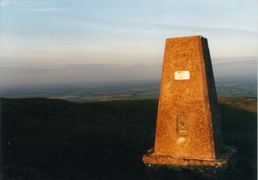
The strangly moved Trig Point of Firle Beacon |
The next Marilyn along the south downs is Firle beacon. The nearest car park is almost at the top of the ridge making the uphill walking bit very easy. If we where really keen hill walking types we would have found a long circular walk but we where peak bagging and playing by different rules. The car park was stuffed full of cars belonging to the paragliders who where throwing themselves off the hill with varying degrees of success. Some seemed to take two steps and then gracefully lift up into the air whilst others tangled themselves up tripped over and remained stubbornly on the ground. We contemplated wandering over and asking to have a go but I don't think that they would It was an easy walk along the south downs way to the beacon, one side we had the Weald of Kent and to the other the seaside and occasionally an odd paraglider just above. The trig point had been moved, it was not at the highest point, it had been once as we could see the old square concrete base. It was defiantly lower, I suspect mystic powers are abroad. We did the photo thing whilst flo found some walkers and begged for food. We walked back to the car as the sun set and the flying men left the sky. Suddenly the realisation dawned, the Long Man was an ancient paraglider who had hit the downs too fast.
 |
| On the top (where the trig point should be) |
 |
Yes a trig point marks the highest place in sussex - what a surprise |
It was almost dark when we got here but seeing as the high point is only a couple of 100 yards from the road, it was on the way home and it is the highest point in Sussex it seemed rude not to. We quickly dashed to the trig. Point to watch the lights of Sussex come on. For some reason the lights of Brighton seemed to twinkle whilst those of Haywards Heath did not, does this mean something?
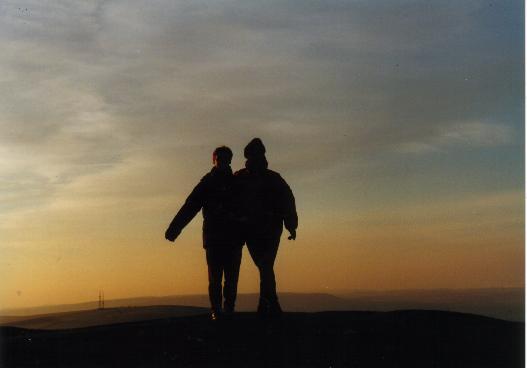
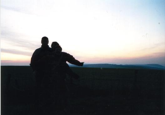
Somewhere out there are three people hiding in the sunset |
 |
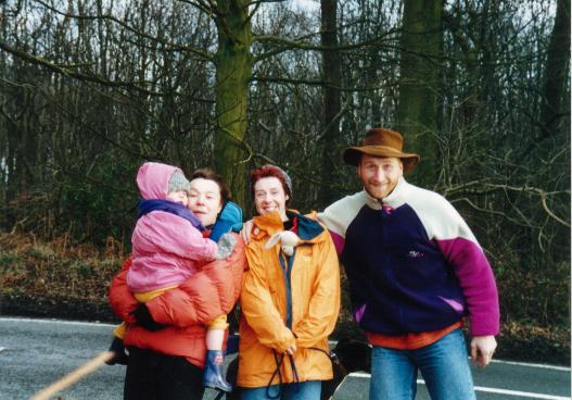
Today we will be the highest people in Surrey as we where about to scale Leith hill and stand on the roof of the county. We started from the landslip car park which seemed to be most of the way up the hill before we started. Not that this was a bad thing seeing as we had three year old Laura with us. The car park was festooned with those ubiquitous police car crime posters that we all ignore, It was far too cold and far too early in the day for a car thief to venture out here, well that's what we hoped. From the car park we followed the muddy path up though the beach trees down a dip and up the other side all the time following the signs to the tower. All the paths around Leith hill are wide and muddy, Just perfect for a bit of mountain biking. We where not the only ones to have this idea, at the top a hoard (saddle, chain or what ever the collective noun for bikes is) of mountain bikers where huddled round the tea shop in the tower at the top of the hill. The Girls bought tickets to scale the tower (Its National Trust) definitely be the highest Girlies in Surrey whilst Flo and I ran round the tower scaring the cyclists, looking at urban mountaineering problems on the tower, watching the grey clouds approach and generally getting cold. After an age the Girls returned to Earth and we started our descent. For the first bit we where accompanied by a cold wind which was rapidly followed by hail and by the time we reached the car, snow. Next time I come here I'm bringing my bike.
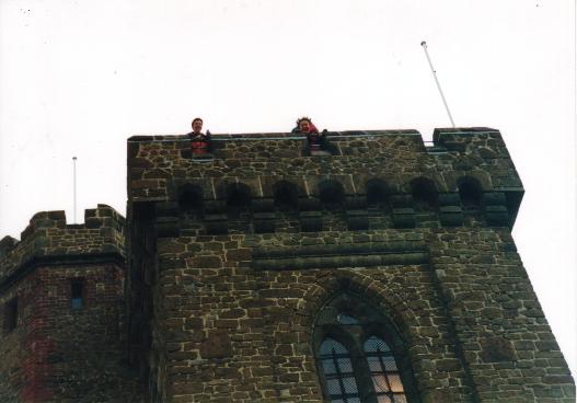 |
The Highest people in Surrey |
 The View? |
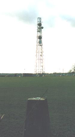
Botley Hill is a
collectors top. There is no reason to visit the top of
the hill, there is no footpath that goes near it and the
view of a couple of radio masts is not exactly awe
inspiring. Add to this that we did the 100 yard walk
along the road from the Titsey estate car park in a
biting wind and that it was threatening to rain or hail.
Plus when we got there we realised that we could have
stopped the car at the edge of the road and taken two
steps to the top and stayed warm and dry into the
bargain. The Botley Hill experience was not that good. It
was time to go home.
The Team - Laura, Sarah, Angela, Rabbit and Pete |